
Comprehensive Guide & Map
The Mesquite Trails map
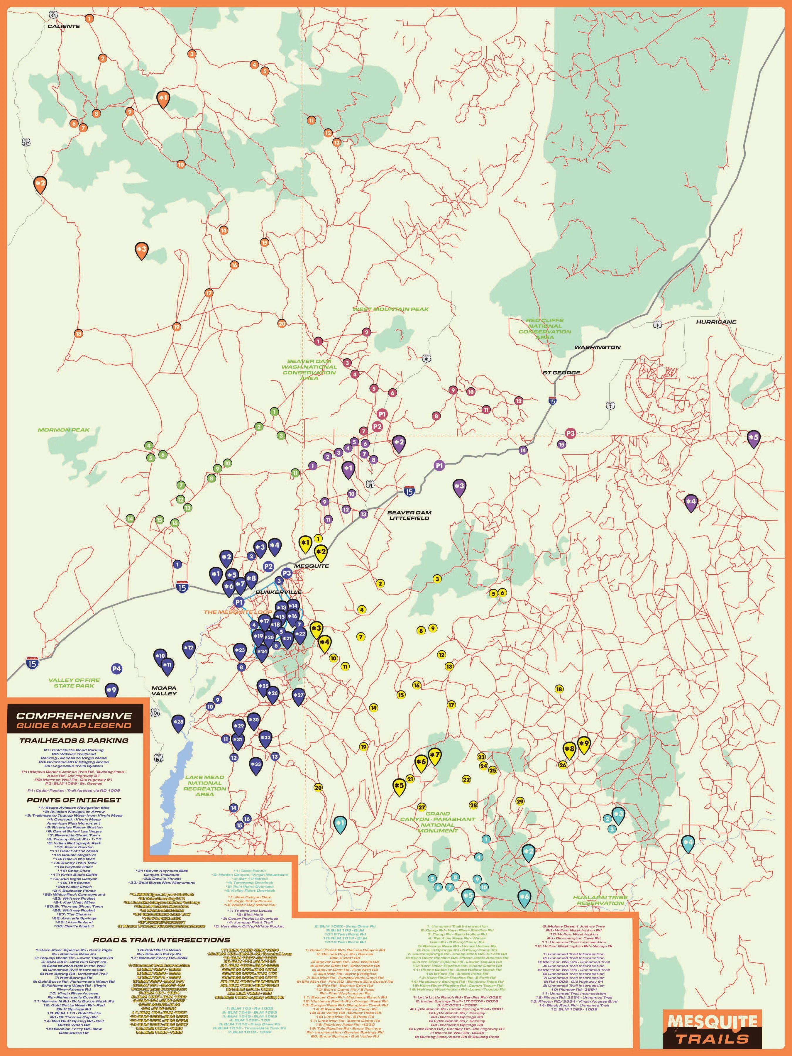
The poster map that goes with the book All Around Mesquite: trailheads and parking, points of interest, and road and trail intersections across the Tri-State area, from Caliente and Moapa Valley to St. George and the Grand Canyon-Parashant National Monument.
The map
 Open the full-size map (2700 by 3600 pixels)
The poster is 18 by 24 inches; the Mesquite Trails mark is in its lower right corner. Select the map to open it at full size (2700 by 3600 pixels), or use the zoomable map on allaroundmesquite.com (opens in a new tab) and its vector PDF with searchable text (opens in a new tab).
How to use it
A map to the general area
The book's trails and destinations sections explain each place; the map locates it. Find the place on the map, read about it in the book, then pin it in your own trail navigation software before you ride.
The book "can serve as a rough trail guide to the general area and location of where these things are so that you can use the software to reference them and better pinpoint the location."
Before you go
The map shows where places are, not whether a road is open today or right for your vehicle. Check the managing agency's page first: the trails by region page links each one, and Know before you go collects their rules on registration, roads, water and weather.
The legend
What the map shows
The map's legend, group by group, in the order it numbers its markers. The map also numbers more than a hundred road and trail intersections (BLM road numbers and named junctions), listed on the poster itself.
Trailheads and parking
- Dark blue P1: Gold Butte Road Parking
- Dark blue P2: Witwer Trailhead Parking - Access to Virgin Mesa
- Dark blue P3: Riverside OHV Staging Arena
- Dark blue P4: Logandale Trails System
- Purple P1: Mojave Desert Joshua Tree Rd / Bulldog Pass - Apex Rd - Old Highway 91
- Purple P2: Mormon Well Rd - Old Highway 91
- Purple P3: BLM 1069 - St. George
- Green P1: Cedar Pocket - Trail Access via RD 1005
Marked P1, P2... in the color of their area.
Dark blue markers: Mesquite, Bunkerville, the Virgin Mesa and Gold Butte, out toward Moapa Valley
- Stupa Aviation Navigation Site
- Aviation Navigation Arrow
- Trailhead to Toquop Wash from Virgin Mesa
- Overlook - Virgin Mesa, American Flag Monument
- Riverside Power Station
- Camel Safari Las Vegas
- Riverside Ghost Town
- Toquop Wash Rd - I-15
- Indian Pictograph Park
- Peace Garden
- Heart of the Mesa
- Double Negative
- Hole in the Wall
- Bundy Train Tank
- Keyhole Rock
- Choo Choo
- Knife-Blade Cliffs
- Gun Sight Canyon
- The Seeps
- Nickel Creek
- Budwiser Fence
- White Rock Campground
- Whitney Pocket
- Key West Mine
- St Thomas Ghost Town
- Whitney Pocket (second marker)
- The Cistern
- Aravada Springs
- Little Finland
- Devil's Nostril
- Seven Keyholes Slot Canyon Trailhead
- Devil's Throat
- Gold Butte National Monument
Yellow markers: The Arizona Strip
- MSR Sign - Airport Outlook
- Tube Crossing I-15
- Lime Kiln Canyon Climber's Camp
- Red Pockets Mountain
- Grand Gulch Mine
- Point Sublime Loop Trail
- Fire Point Loop
- Trumbull Cemetery
- Mount Trumbull Historical Schoolhouse
Teal markers: Grand Canyon-Parashant National Monument
- Tassi Ranch
- Hidden Canyon / Virgin Mountains
- Bar 10 Ranch
- Toroweap Overlook
- Twin Point Overlook
- Kelley Point Overlook
Orange markers: Lincoln County, around Caliente
- Pine Canyon Dam
- Elgin Schoolhouse
- Walter Ray Memorial
Purple markers: Beaver Dam, Littlefield and the St. George side
- Thelma and Louise
- Sink Hole
- Cedar Pockets Overlook
- Jumpup Point Trail
- Vermilion Cliffs / White Pocket
The book
The stories behind the markers
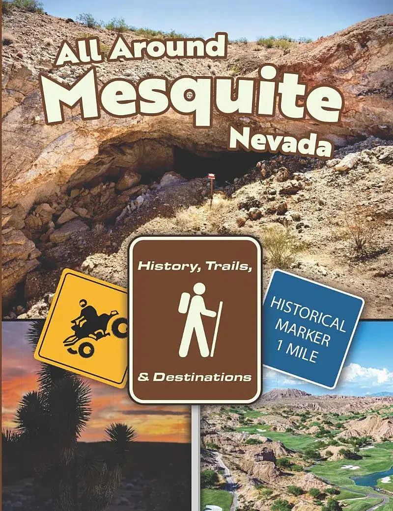
The trails and destinations section of All Around Mesquite explains each place the map marks, region by region, with the history behind it.